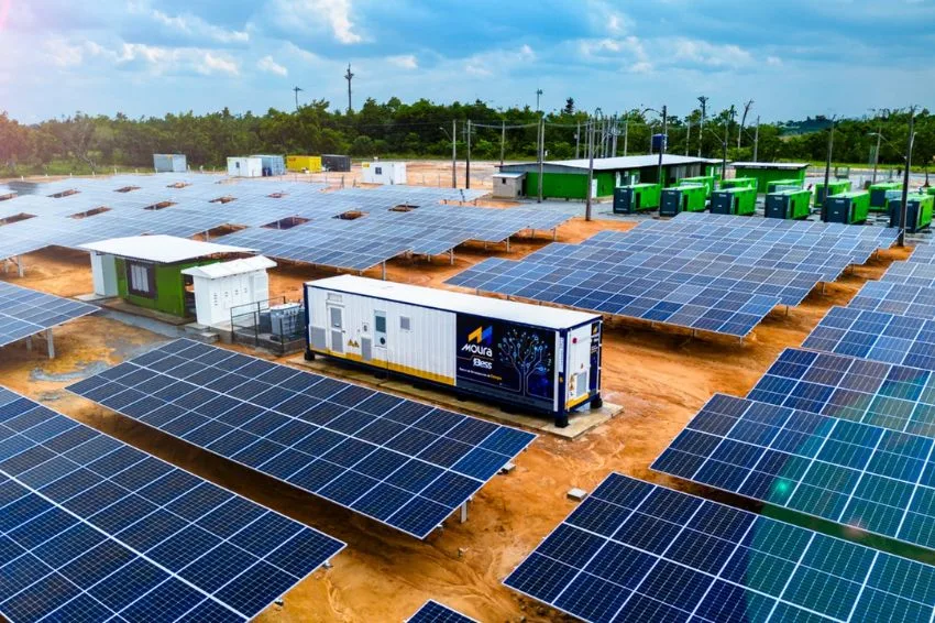
Professionals in the photovoltaic sector need to use all the technologies at their disposal to ensure maximum performance of solar energy projects. In places or roofs with incidence of shadows, especially in urban regions, it is recommended to carry out three-dimensional (3D) modeling of the system already in the project design phase. 3D modeling is used in software such as PVSyst to help decide on the best locations for placing solar panels, as well as to forecast energy generation when shadows cannot be avoided. It is not recommended to carry out a photovoltaic project without knowing the impact of shadows, whatever the size of the project. The study of shadows is often ignored by professionals who still have little knowledge on the subject and especially by clients, who are unaware of the effect of shadows on the performance of the systems they are purchasing. The photovoltaic system designer's routine always involves a prior visit to the installation site to survey the building's measurements, roof measurements, obtain level curves (in ground installations) and become aware of possible objects that could cause shading. With the measurements in hand, the professional can carry out modeling of the construction and the photovoltaic system. The traditional way of carrying out 3D modeling is through graphic software such as AutoCAD, Sketchup or the solar simulation software's own graphic tool, such as PVSyst. A simple 3D model, with few details, may be sufficient for the purpose of modeling the photovoltaic system. This 3D model can be developed in PVSyst itself by the photovoltaic system designer or can be imported into the software from an external file created by another professional. If a simple 3D model is not sufficient and if a more complex model is necessary, the photovoltaic system designer has the option of capturing a three-dimensional model using a drone. In addition to the ease of modeling, flying over the roof with a drone avoids the need to climb onto the roof, eliminating the risk of accidents, the risk of breaking tiles or even the risk of errors in measurements. 3D modeling with a drone improves the quality of the data collected, optimizes the designer's time, reduces costs and allows the creation of a generation project with greater precision, just with the use of some tools that can be available to all professionals in the sector.
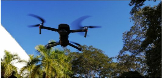
Drone: an excellent investment
To carry out the 3D modeling process of the installation site, the main tool is the drone. He is the one who flies over the location and captures the images that will serve as support for building the model. On the market today we find drones of different brands and prices, which can do what we are going to propose in this article. Whatever your drone, it's a good investment. Not only because you can obtain 3D models, but also because the drone always provides great assistance during visits, reducing the costs of mobilizing people and time.

3D modeling: enhancing projects with a drone
3D modeling from images obtained with a drone consists, in short, of superimposing images captured at different angles and positions. This is how we can map an object, define its height and later analyze its impact on the solar plant, or define the characteristics of an installation roof, noting its orientation and inclination, without having to run the risk of climbing onto it. To carry out 3D modeling it is necessary to insert a little artificial intelligence into the use of the drone. The drone does not (yet) carry out the entire process alone. However, the process is relatively simple, as we will see below. We must have access, in addition to the drone, to software in which a flight plan can be programmed. The flight plan is necessary for the drone to be coordinated and record images automatically. The flight plan defines the region to be flown over, the distance each image must be and the height of the flight. The drone does the rest on its own. Next, another software will process these images, superimposing them and delivering the three-dimensional model.


There are several software options on the market that perform these tasks (flight plan and image capture). Some tools perform both tasks simultaneously or separately, some make flight plans available for free and many of them have trial versions that provide trial time or some free features. It is up to the user to choose the software that best suits their design profile. Examples of software that carries out flight plans: Dronedeply, DJI Ground Station Pro, Skydrones, Precision Flight and Pix4D. The images, after being collected during the flight, are gathered and processed in software such as Agisoft Metashape.


Using the 3D model in PVSyst
PVSyst is simulation software that allows you to estimate the energy generation of the solar system. It is important to carry out system simulation in software such as PVSyst to determine, among other things, the impact of shadows on generation. Simulation enables a detailed analysis of losses, which provides us with a range of information to correct problems already in the initial design phase. With the 3D modeling carried out, we were able to easily insert it into PVSyst to simulate generation in different scenarios. The 3D model obtained with a drone is more accurate than the one created using drawings, as it has the real dimensions and distances of the objects in the project.

Once the ideal scenario has been defined, the model itself serves as support for the executive project, allowing adjustment of the installation location, in addition to defining the particularities of the strings and the safest and easiest way to install. With this project optimization, we increase our decision-making power, making the project more assertive and reducing the designer's effort. We are also able to deliver a final generation report to the client, which strengthens our relationships based on precisely calculated numbers in the generation project.


Conclusion
The drone is a powerful tool for the photovoltaic system designer. In addition to simpler tasks such as inspection of roofs and land, the drone can be used to precisely survey three-dimensional models. Three-dimensional models carry all the information about the shapes and dimensions of buildings and objects captured in aerial images. The process of obtaining 3D models saves the work of modeling through drawings and brings more precision and reliability to photovoltaic projects.
new RDStationForms('interesse-em-cursos-articles-do-canal-solar-2a68fc32cce5530fe808', 'UA-145443047-1').createForm();