
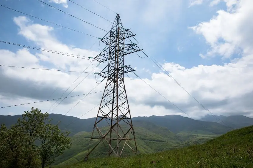
The expansion of transmission infrastructure in Brazil presents new challenges for project planning, especially in the choice of routes and the identification of environmental, land, and engineering constraints.
In this context, the use of AI (artificial intelligence) is beginning to gain ground in the processes of analyzing and developing new assets.
One of the initiatives in this regard is GoBid, a platform developed by Taesa Ventures, in partnership with Ambientare Geotech, to automate territorial studies and assist in defining transmission line routes.
The tool was created as part of an R&D (Research, Development and Innovation) project by ANEEL (National Electric Energy Agency), identified by number PD-07130-0061/2025.
The proposal is to use geospatial data and AI to evaluate different possibilities for deploying power lines, considering in advance factors that may influence the viability of the projects and their licensing process.
In tests conducted with all of Taesa's deployed transmission lines, the platform achieved 86% accuracy in selecting the correct tower type for each route.
The system was also applied to the EPE (Energy Research Company) database, which comprises 2.200 transmission lines. The analysis allowed for the identification of patterns and the development of mathematical models to assist in the creation of new projects.
Route planning and constraint analysis
Choosing the route for a transmission line involves various territorial variables. Terrain characteristics, vegetation, land use, the presence of buildings, and proximity to environmentally protected areas can all influence engineering alternatives.
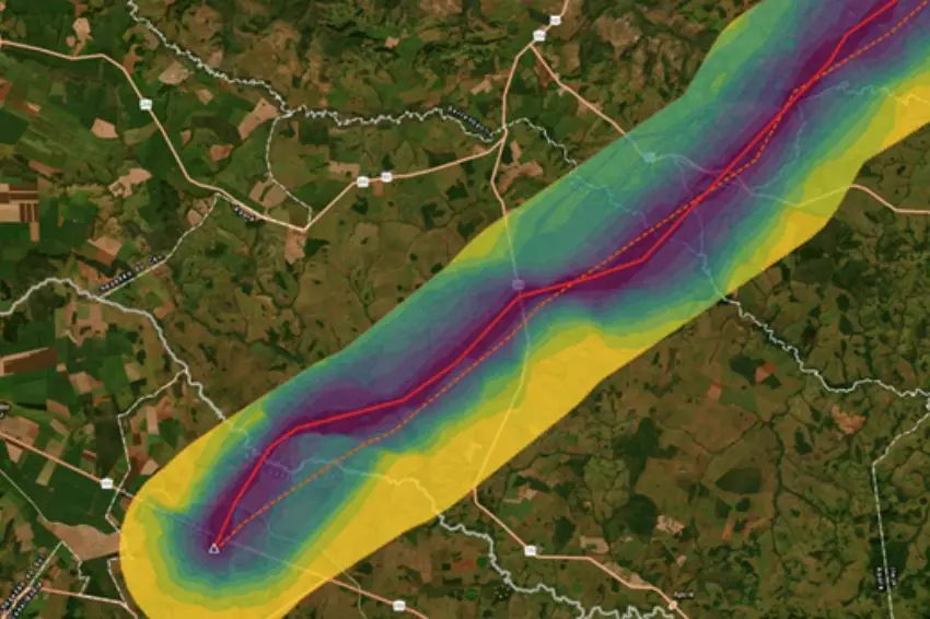
GoBid currently gathers 320 layers of geospatial information to perform these assessments. The data considered include restricted areas, indigenous territories, improvements, environmental characteristics, and engineering parameters.
Based on the delimitation of an area of interest, the platform can generate alternative routes, indicate possible locations for towers, and present preliminary cost estimates and regulatory indicators.
For each corridor analyzed, hundreds of scenarios can be generated, according to the criteria established by the user. The tool also considers the Terms of Reference of IBAMA (Brazilian Institute of Environment and Renewable Natural Resources), allowing for the prior identification of relevant environmental requirements for licensing.
-

Photo: GoBid Project/Reproduction
The use of this type of technology can help anticipate constraints that, if identified in later stages, would require revisions to the designs and new engineering assessments.
According to Mauricio Dall'Agnese, Business Director at Taesa, the integration between generative artificial intelligence and geospatial analysis makes it possible to reduce the time needed to evaluate deployment alternatives.
“The GoBid project completely changes the way transmission lines are planned by combining generative artificial intelligence and geospatial analysis in a single environment. Taesa Ventures sees immense value in the autonomy generated by the platform, which reduces the time to define routes from weeks to minutes. The tool delivers optimized scenarios with budget estimates and exportable reports, ensuring traceable decisions and guaranteeing that each client's data remains strictly isolated and confidential.”
Marcos Vilela, one of the platform's developers, highlights the importance of territorial information for project development.
“Planning a transmission line requires multidisciplinary knowledge, and the data that supports this knowledge is 100% territorial. Information such as slope, land use, restricted areas, areas with high commercial value, and environmental sensitivity are all information that we model and analyze in a Geographic Information System (GIS). Combining this technique with artificial intelligence has enhanced our analytical capacity and transformed slow processes into dynamic ones, weeks into minutes, and, most importantly, adapted each company's strategy to a quick and assertive result,” he emphasizes.
Expanding transmission requires planning.
The development of tools to automate engineering studies is occurring at a time of expansion of Brazil's transmission infrastructure.
The PDE (Ten-Year Energy Expansion Plan) 2036 foresees investments of R$ 127,1 billion in the sector between 2027 and 2036. The plan also includes the construction of approximately 31,9 kilometers of new transmission lines and the addition of 99,6 MVA to the transformation capacity of substations.
The volume of projects projected for the next decade increases the need for technical and territorial studies capable of supporting the definition of new ventures.
In this scenario, artificial intelligence and geospatial analysis tools can gain relevance by allowing the simultaneous evaluation of different route alternatives, with information on costs, territorial restrictions, and environmental requirements.
Developed from an R&D project by ANEELGoBid represents an application of these technologies to the planning of transmission assets, a stage that precedes the implementation of projects and can influence their technical, economic, and environmental viability.
all the content of Canal Solar is protected by copyright law, and partial or total reproduction of this site in any medium is expressly prohibited. If you are interested in collaborating or reusing part of our material, please contact us by email: redacao@canalsolar.com.br.



Comments
Comments are moderated before publication.Comments should be respectful and contribute to a healthy debate. Offensive comments may be removed. The opinions expressed here are those of the authors and do not necessarily reflect the views of the author. Canal Solar.